
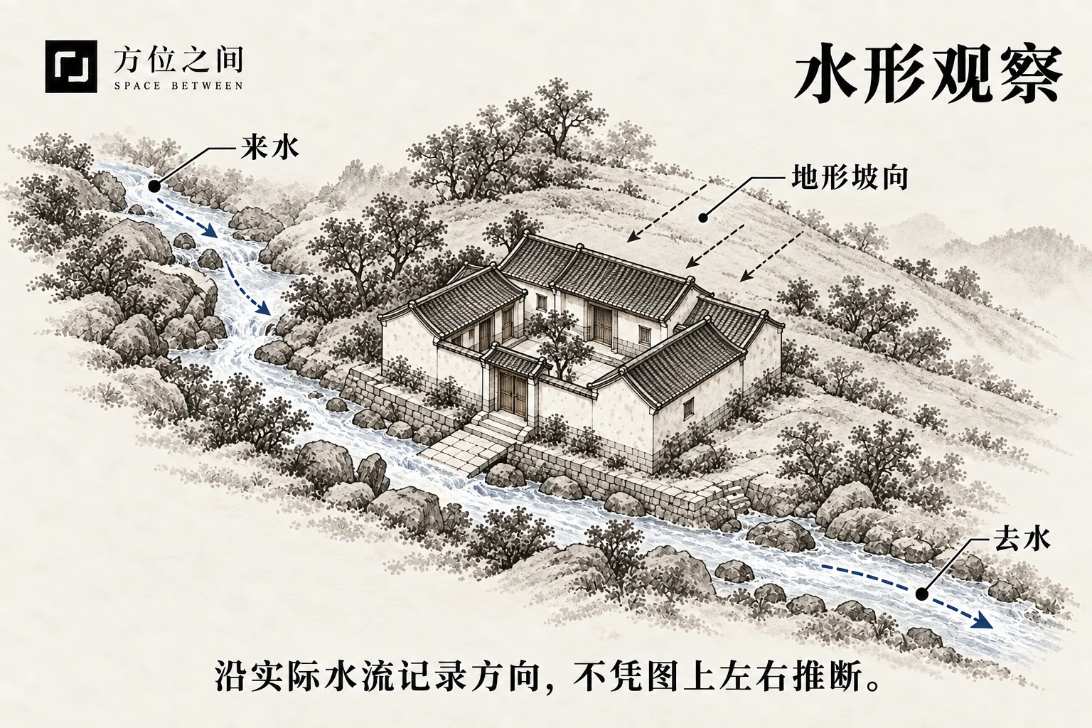
Identify the kind of water being observed
Streams, ditches, rain-generated surface runoff and still ponds differ. Traditional terms such as incoming water, outgoing water and outlet also need an observation point and scope. A ditch may be a courtyard outlet but an inlet to a larger catchment. Draw boundaries, positions and connections before assigning names, so a distant visible water surface is not confused with the nearby drainage network.
Terrain and surface conditions both affect runoff
Gravity moves water downslope, while rainfall intensity, slope, soil infiltration and vegetation affect surface runoff. Impervious roofs and paving change collection and drainage. A curved line on a plan cannot by itself establish flow speed or ponding likelihood. Record levels, channel connections, obstructions and differences between dry and rainy conditions; use professional measurement where needed.
Separate the viewing direction from flow
Standing on a courtyard’s south side, you may look north toward a ditch while its water flows east to west. The viewing direction is north, but flow is westward. A courtyard sloping from north to south toward a southern drain may collect water southward, yet roof discharge, curbs and local depressions alter specific paths. Draw one line for the sightline and another arrow for observed flow, recording date and weather.
Keep cultural descriptions separate from site conclusions
Traditional descriptions such as encircling, straight outflow and convergence can serve as shape vocabulary; attached claims about wealth or descendants form a separate interpretation. Site conclusions should trace back to photographs, slope, rain marks and drainage connections. If movement was not observed, write “flow direction unconfirmed” instead of inferring it from a bend. Ponding prevention and drainage capacity depend on actual conditions and professional design.
Sources and further reading
These sources help clarify the concepts and their origins. Explaining a traditional term does not establish that it can predict outcomes.